File:1891 Block 60 Sanborn map.jpg
Jump to navigation
Jump to search

Size of this preview: 800 × 595 pixels. Other resolution: 829 × 617 pixels.
Original file (829 × 617 pixels, file size: 83 KB, MIME type: image/jpeg)
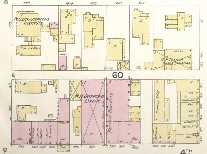
Detail from the 1891 Sanborn Map Co. "Fire Insurance Map of Birmingham, Ala.", held at the Library of Congress (link)
| Public Domain | |
| This work was published in the United States before 1928 and is now presumed to be in the public domain. | |
File history
Click on a date/time to view the file as it appeared at that time.
| Date/Time | Thumbnail | Dimensions | User | Comment | |
|---|---|---|---|---|---|
| current | 11:14, 17 March 2020 | | 829 × 617 (83 KB) | Dystopos (talk | contribs) | Detail from the 1891 Sanborn Map Co. "Fire Insurance Map of Birmingham, Ala.", held at the Library of Congress ([http://hdl.loc.gov/loc.gmd/g3974bm.g3974bm_g000151891 link]) {{PD}} |
You cannot overwrite this file.
File usage
The following page uses this file: