File:Roberts Field map.jpg
Jump to navigation
Jump to search

No higher resolution available.
Roberts_Field_map.jpg (615 × 358 pixels, file size: 106 KB, MIME type: image/jpeg)
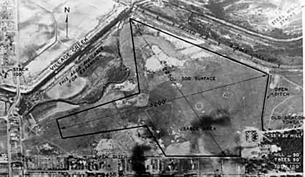
1937 aerial photograph of Roberts Field from airfields-freeman.com (link)
| Fair Use media | |
| This work is subject to copyright and/or trade mark protection. It is used here without express permission under the legal doctrine of Fair Use. Rights to the work remain the sole property of the creator. See Bhamwiki:Copyrights for further information. | |
File history
Click on a date/time to view the file as it appeared at that time.
| Date/Time | Thumbnail | Dimensions | User | Comment | |
|---|---|---|---|---|---|
| current | 21:22, 26 March 2014 | | 615 × 358 (106 KB) | Dystopos (talk | contribs) | 1937 aerial photograph of Roberts Field from airfields-freeman.com ([http://www.airfields-freeman.com/AL/Airfields_AL_Birmingham.htm#roberts link]) {{Fair Use}} |
You cannot overwrite this file.
File usage
The following page uses this file: