File:April 2011 tornado tracks.png
Jump to navigation
Jump to search
Size of this preview: 800 × 545 pixels. Other resolution: 957 × 652 pixels.
Original file (957 × 652 pixels, file size: 1.13 MB, MIME type: image/png)
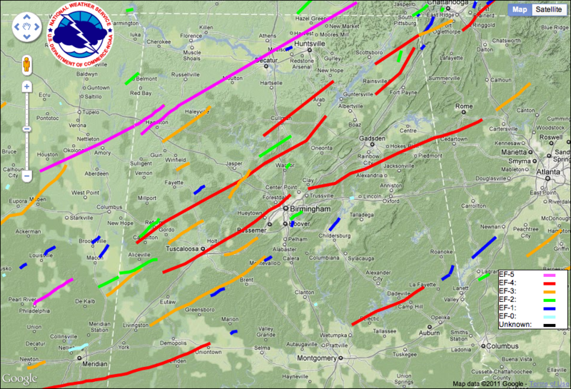
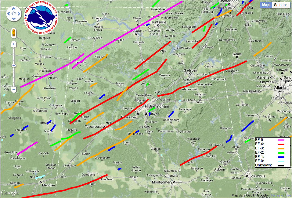
Tracks of confirmed tornadoes across Northern Alabama during the April 2011 tornado outbreak. Compiled by the National Weather Service (link)
| This work is in the public domain | |
| This work was created by the United States Government and is in the public domain. | |
File history
Click on a date/time to view the file as it appeared at that time.
| Date/Time | Thumbnail | Dimensions | User | Comment | |
|---|---|---|---|---|---|
| current | 18:13, 9 July 2011 | | 957 × 652 (1.13 MB) | Dystopos (talk | contribs) | |
| 07:13, 18 May 2011 | 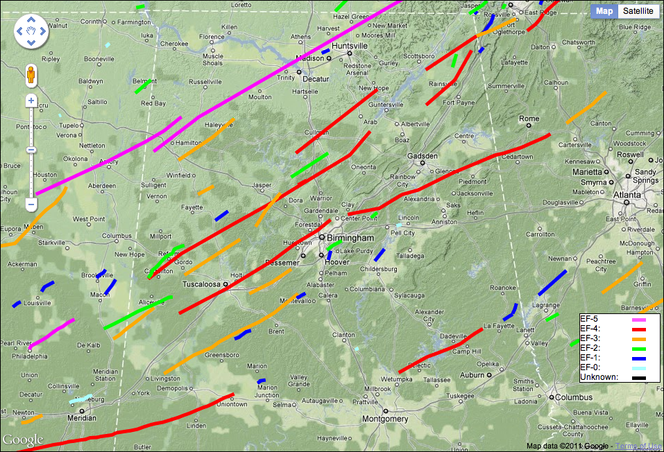 | 957 × 652 (1.13 MB) | Dystopos (talk | contribs) | ||
| 07:06, 18 May 2011 | 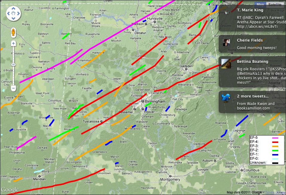 | 957 × 652 (1.12 MB) | Dystopos (talk | contribs) | Tracks of confirmed tornadoes across Northern Alabama during the April 2011 tornado outbreak. Compiled by the National Weather Service ([http://www.srh.noaa.gov/srh/ssd/mapping/ link]) {{PD-Gov}} |
You cannot overwrite this file.
File usage
The following 2 pages use this file: