File:Bham Council Districts.png: Difference between revisions
Jump to navigation
Jump to search
(Map of Birmingham City Council Districts, as of 2013, from gisweb.informationabirmingham.com {{Fair Use}}) |
(No difference)
|
Latest revision as of 10:12, 26 April 2017
Map of Birmingham City Council Districts, as of 2013, from gisweb.informationabirmingham.com
| Fair Use media | |
| This work is subject to copyright and/or trade mark protection. It is used here without express permission under the legal doctrine of Fair Use. Rights to the work remain the sole property of the creator. See Bhamwiki:Copyrights for further information. | |
File history
Click on a date/time to view the file as it appeared at that time.
| Date/Time | Thumbnail | Dimensions | User | Comment | |
|---|---|---|---|---|---|
| current | 10:12, 26 April 2017 | 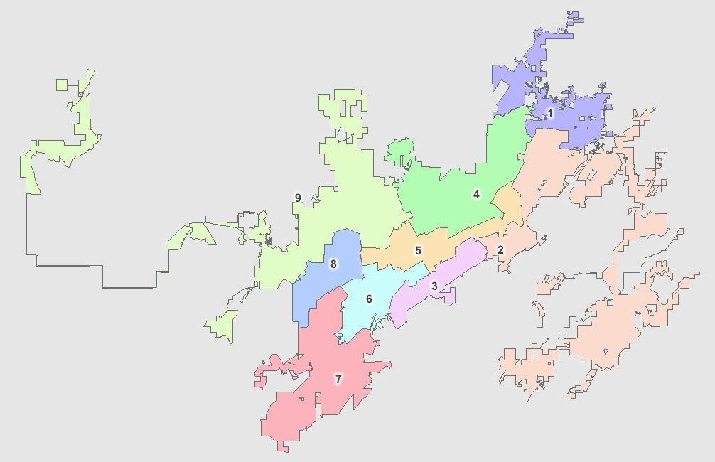 | 1,006 × 650 (323 KB) | Dystopos (talk | contribs) | Map of Birmingham City Council Districts, as of 2013, from gisweb.informationabirmingham.com {{Fair Use}} |
You cannot overwrite this file.
File usage
The following 10 pages use this file:
- Birmingham City Council District 1
- Birmingham City Council District 2
- Birmingham City Council District 3
- Birmingham City Council District 4
- Birmingham City Council District 5
- Birmingham City Council District 6
- Birmingham City Council District 7
- Birmingham City Council District 8
- Birmingham City Council District 9
- Birmingham City Council districts