Category:Maps: Difference between revisions
Jump to navigation
Jump to search
(New page: Category:Images) |
(No difference)
|
Latest revision as of 20:54, 24 March 2010
Subcategories
This category has the following 2 subcategories, out of 2 total.
Pages in category "Maps"
The following 3 pages are in this category, out of 3 total.
Media in category "Maps"
The following 28 files are in this category, out of 28 total.
 10th Street South 1959.png 476 × 668; 676 KB
 1818 Tullavahajah map.PNG 984 × 730; 1.61 MB
- Error creating thumbnail: File with dimensions greater than 12.5 MP1821 Elyton map.jpg 7,223 × 7,739; 2.65 MB
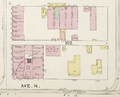
 1885 Sanborn block 86.png 800 × 635; 630 KB
 1889 Red Mtn Cemetery map.jpg 849 × 697; 281 KB
 1891 Sanborn map Block 102.png 937 × 760; 782 KB
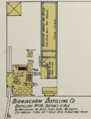 1902 Sanborn Bham Distilling.png 612 × 803; 753 KB
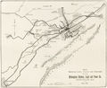 1903 Birmingham Railway Light & Power map.jpg 1,600 × 1,311; 343 KB
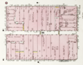 1911 Sanborn block 86.png 839 × 659; 858 KB
 1929 tax map Block 86.jpg 800 × 664; 283 KB
 1948 Camp Fletcher map.png 373 × 791; 70 KB
 1957 Oporto Avenue map.PNG 538 × 557; 406 KB
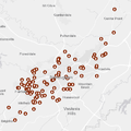
 Bham homicides 2008.png 480 × 480; 126 KB
 Bham homicides 2009.png 480 × 480; 128 KB
 Bham homicides 2010.png 480 × 480; 111 KB
 Bham homicides 2011.png 480 × 480; 113 KB
 Bham homicides 2012.png 480 × 480; 116 KB
 Bham homicides 2013.png 480 × 480; 115 KB
 Bham homicides 2014.png 480 × 480; 112 KB
 Bham homicides 2015.png 480 × 480; 119 KB
 Bham homicides 2016.png 480 × 480; 121 KB
 Bham homicides 2017.png 480 × 480; 124 KB
 Bham homicides 2018.png 480 × 480; 124 KB
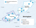 Birmingham On-Demand service area map.png 601 × 480; 205 KB
 RailroadRes 1880 map.jpg 500 × 400; 88 KB
 Smith's Park 1898.jpg 400 × 328; 97 KB
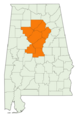
 Birmingham-Hoover MSA map.png 375 × 573; 71 KB
 Birmingham-Hoover-Cullman CSA map.png 375 × 573; 71 KB


