File:Bham Mineral RR 1930.png
Jump to navigation
Jump to search
Size of this preview: 623 × 600 pixels. Other resolution: 720 × 693 pixels.
Original file (720 × 693 pixels, file size: 292 KB, MIME type: image/png)
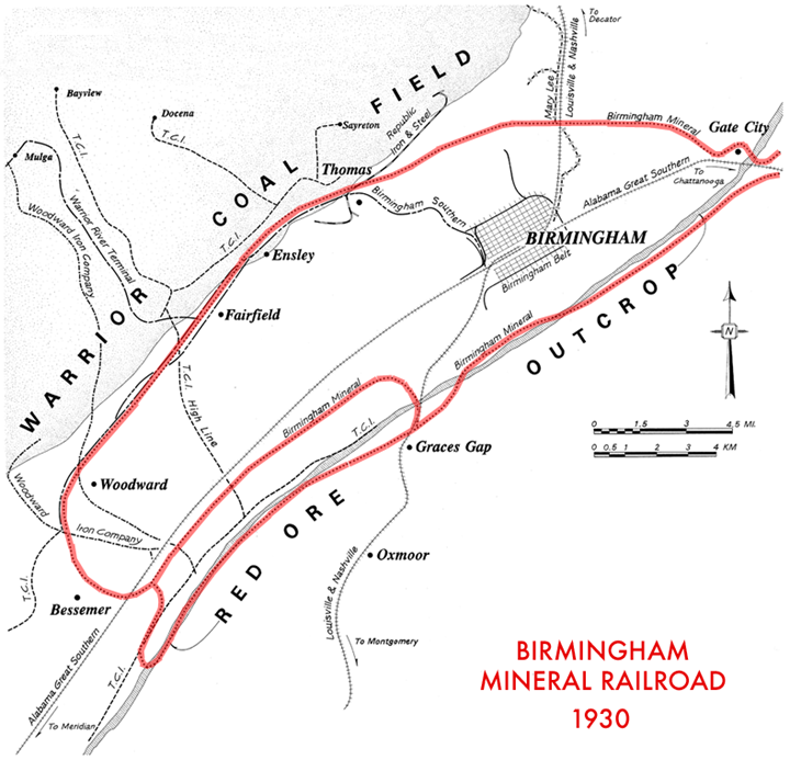
Map of the Birmingham Mineral Railroad.
Modified from a map drawn by Nichole N. Duren in 1992 as part of the documentation of the "Birmingham District Railroads, Birmingham vicinity, Jefferson County, AL" for the Historic American Engineering Record.
| This work is in the public domain | |
| This work was created by the United States Government and is in the public domain. | |
File history
Click on a date/time to view the file as it appeared at that time.
| Date/Time | Thumbnail | Dimensions | User | Comment | |
|---|---|---|---|---|---|
| current | 23:40, 29 August 2007 | | 720 × 693 (292 KB) | Dystopos (talk | contribs) | Map of the Birmingham Mineral Railroad. Modified from a map drawn by Nichole N. Duren in 1992 as part of the documentation of the "[http://hdl.loc.gov/loc.pnp/hhh.al0908 Birmingham District Railroads, Birmingham vicinity, Jefferson County, AL]" for t |
You cannot overwrite this file.
File usage
The following 2 pages use this file: