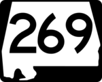
Alabama State Highway 269: Difference between revisions
No edit summary |
m (Typo, indentation, template.) |
||
| Line 1: | Line 1: | ||
[[File:Alabama 269 sign.png|right|150px]] | [[File:Alabama 269 sign.png|right|150px]] | ||
'''Alabama State Highway 269''' or '''Alabama State Route 269''' ('''AL-269''' or '''SR-269''') is a 66-mile route that extends northwestward from [[Birmingham]] to [[Jasper]]. The route runs west of [[U.S. Highway 78]] and roughly parallels that route. Other | '''Alabama State Highway 269''' or '''Alabama State Route 269''' ('''AL-269''' or '''SR-269''') is a 66-mile route that extends northwestward from [[Birmingham]] to [[Jasper]]. The route runs west of [[U.S. Highway 78]] and roughly parallels that route. Other cities and towns along the route include [[Maytown]], [[Sylvan Springs]], and [[Parrish]]. | ||
==Route description== | ==Route description== | ||
| Line 10: | Line 10: | ||
===[[Jefferson County]]=== | ===[[Jefferson County]]=== | ||
====[[Birmingham]]==== | ====[[Birmingham]]==== | ||
{{Hatnote|For a more detailed list of locations, see [[20th Street Ensley]].}} | |||
* Highway terminus (road continues south as [[21st Street Ensley]]) | * Highway terminus (road continues south as [[21st Street Ensley]]) | ||
* [[Interstate 59]]/[[Interstate 20]] interchange | * [[Interstate 59]]/[[Interstate 20]] interchange | ||
* [[Ensley 5 Points West Avenue]] intersection | * [[Ensley 5 Points West Avenue]] intersection | ||
* [[Tuxedo Terrace]] public housing project | ** [[Tuxedo Terrace]] public housing project | ||
* | * Downtown Ensley | ||
* [[Avenue E Ensley]] intersection | * [[Avenue E Ensley]] intersection | ||
* [[Don Drennen Overpass]] | * [[Don Drennen Overpass]] | ||
| Line 23: | Line 23: | ||
* [[Slayden Avenue]] intersection | * [[Slayden Avenue]] intersection | ||
* [[Lexington Street]]/[[Minor Parkway]] intersection | * [[Lexington Street]]/[[Minor Parkway]] intersection | ||
{{Hatnote|For a more detailed list of locations, see [[Birmingport Road]].}} | |||
* [[McDonald Chapel Road]]/[[Xavier Street]] intersection | * [[McDonald Chapel Road]]/[[Xavier Street]] intersection | ||
* [[McDonald Chapel]] community | * [[McDonald Chapel]] community | ||
| Line 61: | Line 62: | ||
** [[Coke Oven Branch]] crossing | ** [[Coke Oven Branch]] crossing | ||
** [[20th Street Jasper]] ([[Alabama State Highway 69]]) intersection | ** [[20th Street Jasper]] ([[Alabama State Highway 69]]) intersection | ||
** | ** Road continues as [[Elliott Boulevard]] ([[Alabama State Highway 69]]) | ||
==References== | ==References== | ||
Latest revision as of 10:04, 18 June 2016
Alabama State Highway 269 or Alabama State Route 269 (AL-269 or SR-269) is a 66-mile route that extends northwestward from Birmingham to Jasper. The route runs west of U.S. Highway 78 and roughly parallels that route. Other cities and towns along the route include Maytown, Sylvan Springs, and Parrish.
Route description
The southern terminus of Highway 269 is at the junction with I-59/20 at Exit 120 in western Birmingham. The route leads through the Ensley community along 20th Street Ensley, passing by the former U.S. Steel Ensley Works. After leaving Birmingham, the route, also called Birmingport Road, leads through several small communities in western Jefferson County into Walker County. The northern terminus of the route is at its junction with Alabama State Highway 69 just west of Jasper.
Notable locations
- For an alphabetical list of locations, see the Alabama State Highway 269 category.
Jefferson County
Birmingham
- For a more detailed list of locations, see 20th Street Ensley.
- Highway terminus (road continues south as 21st Street Ensley)
- Interstate 59/Interstate 20 interchange
- Ensley 5 Points West Avenue intersection
- Tuxedo Terrace public housing project
- Downtown Ensley
- Avenue E Ensley intersection
- Don Drennen Overpass
- Sherman Heights neighborhood
- Pleasant Hill Road intersection
- Slayden Avenue intersection
- Lexington Street/Minor Parkway intersection
- For a more detailed list of locations, see Birmingport Road.
- McDonald Chapel Road/Xavier Street intersection
- McDonald Chapel community
- Minor community
- Edgewater community
- Bayview Lake crossing
- New Mulga Loop Road (Jefferson County Road 80) intersection
- Old Mulga Loop Road intersection (Crockard Junction)
- Shady Grove Road (Jefferson County Road 45) intersection
- Ben Vines Gap
- Sylvan Springs
- Pleasant Grove Sylvan Springs Road intersection
- Rock Creek Road (Jefferson County Road 41) intersection
- Hoagtown community
- William Howton Road intersection
- Short Creek crossing
- Birmingport community
- Locust Fork crossing
- Powhatan community
- Skelton Creek crossing
- Flat Top Road/Alliance Road intersection
Walker County
- Pumpkin Center community
- Pumpkin Center Cut Off Road intersection
- Mulberry Fork crossing (former Copeland Ferry)
- Cordova Gorgas Road (Walker County Road 61) intersection
- Goodsprings Road (Walker County Road 57) intersection
- Goodsprings community
- Bryants Creek crossing
- Parrish
- Parrish-Oakman Highway/New Parish Highway (Walker County Road 20) intersection
- Bullbarn Creek crossing
- Cane Creek crossing
- I-22/U.S. Highway 78 interchange
- Jasper
- Coke Oven Branch crossing
- 20th Street Jasper (Alabama State Highway 69) intersection
- Road continues as Elliott Boulevard (Alabama State Highway 69)
References
- Alabama State Route 269. (June 17, 2014). Wikipedia - accessed June 13, 2016
