File:Colony locator map.png
Jump to navigation
Jump to search
No higher resolution available.
Colony_locator_map.png (500 × 346 pixels, file size: 46 KB, MIME type: image/png)
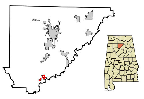
Map showing the size and location of Colony in Cullman County and in Alabama. Created by Wikipedia User:Arkyan using Census Bureau data and released under multiple licenses, including CC-BY-SA 3.0. (link to original at commons.wikimedia.org)
| Image License | |
| This image is licensed under the terms of Creative Commons Attribution Share-Alike v3.0 | |
| Media Type: City locator map | |
| This map shows the location of a city in its county and state. See licensing template for copyright status. | |
File history
Click on a date/time to view the file as it appeared at that time.
| Date/Time | Thumbnail | Dimensions | User | Comment | |
|---|---|---|---|---|---|
| current | 10:02, 6 May 2019 | | 500 × 346 (46 KB) | Dystopos (talk | contribs) | Map showing the size and location of Colony in Cullman County and in Alabama. Created by Wikipedia User:Arkyan using Census Bureau data and released under multiple licenses, including CC-BY-SA 3.0. ([http://commons.wikimedia.org/wiki/File:C... |
You cannot overwrite this file.
File usage
The following page uses this file: