University Boulevard: Difference between revisions
No edit summary |
David Bains (talk | contribs) |
||
| (10 intermediate revisions by 3 users not shown) | |||
| Line 42: | Line 42: | ||
*** 1212: [[12th Street Deck]] | *** 1212: [[12th Street Deck]] | ||
* [[13th Street South]] intersection | * [[13th Street South]] intersection | ||
** | ** north side | ||
*** 1300: [[Campbell Hall]] (1978-) | *** 1300: [[Campbell Hall]] (1978-) | ||
** | ** south side | ||
*** former location of [[Cameron Elementary School|Cameron School]] (1892-1940s) | *** former location of [[Cameron Elementary School|Cameron School]] (1892-1940s) | ||
* [[14th Street South]] intersection | * [[14th Street South]] intersection | ||
** | ** north side | ||
*** [[Hill University Center]] | *** [[Hill University Center]] | ||
** | ** south side | ||
*** [[Heritage Hall]] | *** [[Heritage Hall]] | ||
*** [[UAB Campus Green]] | *** [[UAB Campus Green]] | ||
**** 1429: former location of [[Rena Lewis]]' restaurant (1942) | |||
* [[15th Street South]] intersection (north only) | * [[15th Street South]] intersection (north only) | ||
** North side | ** North side | ||
*** Parking lot | *** Parking lot | ||
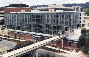
[[Image:School_of_Nursing,_2018_addition.jpg|right|thumb|300px|UAB School of Nursing building in 2018]] | [[Image:School_of_Nursing,_2018_addition.jpg|right|thumb|300px|UAB School of Nursing building in 2018]] | ||
** | ** south side: | ||
*** [[UAB Campus Recreation Center]] | *** [[UAB Campus Recreation Center]] | ||
*** 1595: Former site of [[University Hall]] (1969–2002) | *** 1595: Former site of [[University Hall]] (1969–2002) | ||
* [[16th Street South]] intersection | * [[16th Street South]] intersection | ||
** | ** north side: | ||
*** 1600: former location of [[Tried Stone Baptist Church]] (1954) | |||
*** 1670: [[Volker Hall]] | *** 1670: [[Volker Hall]] | ||
*** 1700: [[Lister Hill Library]] | *** 1700: [[Lister Hill Library]] | ||
| Line 79: | Line 81: | ||
** North side | ** North side | ||
*** 1900: [[Tinsley Harrison Tower]] | *** 1900: [[Tinsley Harrison Tower]] | ||
*** 1912: former location of [[ | *** 1912: former location of [[Public Health Building]] (built 1948, demolished 1980) | ||
*** 1918: [[McCallum Basic Health Sciences Building]], former location of [[St John's Methodist Church]] (1899-1941) | *** 1918: [[McCallum Basic Health Sciences Building]], former location of [[St John's Methodist Church]] (1899-1941) | ||
** South side | ** South side | ||
*** [[University Boulevard Parking Deck]] | *** [[University Boulevard Parking Deck]] | ||
*** [[University Tower]] (unbuilt proposal from [[1960]], proposed at the intersection with 19th Street South) | |||
*** [[Doubletree Hotel Birmingham]] | *** [[Doubletree Hotel Birmingham]] | ||
*** 1913: former location of [[Wiseola Company]] (1905) | *** 1913: former location of [[Wiseola Company]] (1905) | ||
*** 1919: [[Cudworth Building]] (1964-present) | *** 1919: [[Cudworth Building]] (1964-present) | ||
* [[20th Street South]] intersection | * [[20th Street South]] intersection | ||
** | ** north side: | ||
*** 2008: [[Westinghouse]] Xray Division (1957) | *** 2008: [[Westinghouse]] Xray Division (1957) | ||
*** 2010: [[ | *** 2010: [[Townhouse Park]] (2020–), former location of [[Town House|Townhouse Apartments]] (built 1953), [[Town House|UAB Town House]] (1985–2017) | ||
**** 2010: former location of [[Mrs Todd's]] restaurant (1953-), former location of [[Tracy' | **** 2010: former location of [[Mrs Todd's]] restaurant (1953-), former location of [[Tracy's Cafeteria]] (1983-2008) | ||
** | *** 2020: former location of [[Baptist Book Store]] (1970) | ||
** south side: | |||
*** 2001: [[Wings Around the Clock]], former location of [[Robert Williamson]] (1919), [[Zoes (Southside)|Zoes]], [[Andrew's Sandwich Shop]] (–1993), [[New York Bagel Cafe]] (1996-2005), [[Starbucks Coffee]] (2005-2008) | |||
*** 2005: former location of [[University Tanning Salon]] (1980s) | *** 2005: former location of [[University Tanning Salon]] (1980s) | ||
*** 2007: | *** 2007: former location of [[Joe Overton]] commercial photographer (1948), [[Technical Space Agency]] (1969), [[Nickelodeon]] boutique (1970), [[Dr Pizza]] (1987), [[Lucy's Coffee and Tea]] (mid-1990s-2020) | ||
*** 2009: [[University Tacos & Burritos]], former location of [[Pangea]] (1997), [[Becky's South]], [[University Grill]] | *** 2009: [[University Tacos & Burritos]], former location of [[Pangea]] (1997), [[Becky's South]], [[University Grill]] | ||
*** 2021: former location of [[Booth's Steam Baths]] ([[E. W. Booth|E. W.]] & [[Marcella Booth]] 1915) | |||
* [[21st Street South]] ([[Richard Arrington Jr Boulevard South]]) intersection | * [[21st Street South]] ([[Richard Arrington Jr Boulevard South]]) intersection | ||
** north side: | ** north side: | ||
| Line 100: | Line 106: | ||
*** 2116: [[Ridout's-Brown Service Southside Chapel]] | *** 2116: [[Ridout's-Brown Service Southside Chapel]] | ||
** south side | ** south side | ||
*** 2101: former location of [[Martin Flowers]] (-2018) | *** 2101: former site of 1-story commercial building (demolished 2023), former location of [[Bradley & Bedsole Paint & Body Shop]], [[Martin Flowers]] ([[Ed Boylen|Ed]] & [[Pam Boylen]] 1997-2018) | ||
*** 2111: former location of [[Dravo Basic Materials Co.]] (1986) | *** 2111: former location of [[Dravo Basic Materials Co.]] (1986) | ||
*** 2117: [[Baptist Church of the Covenant]] | *** 2117: [[Baptist Church of the Covenant]] | ||
Latest revision as of 14:39, 30 April 2024
- This article is about Southside avenue. For other uses, see University Boulevard (disambiguation).
- Not to be confused with University Avenue or Avenue H Ensley.
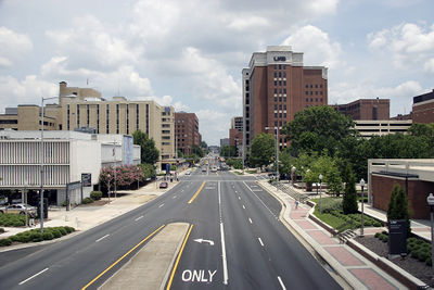
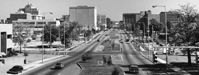
University Boulevard (originally Avenue H, then 8th Avenue South) is an east-west corridor in Birmingham's Southside community connecting Green Springs Highway to Clairmont Avenue. It stretches from 16th Avenue South through the Five Points South neighborhood and UAB campus, for which it is named, to 29th Street South. From Green Springs Highway to the Elton B. Stephens Expressway, University Boulevard also makes up part of Alabama State Highway 149.
The majority of University Boulevard is five-lanes wide, including the center turn lane. Portions through the UAB campus feature a landscaped median.
University Boulevard acts as the border between the Glen Iris and Five Points South neighborhoods from 500 to 700 University Boulevard and again from the bottom of the Interstate 65 north exit ramp to 11th Street South. From the Elton B. Stephens Expressway to 29th Street, University acts as the border between the Southside and Highland Park neighborhoods.
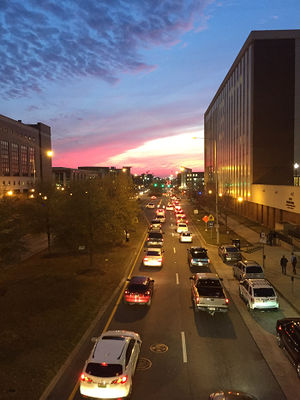
It has the highest traffic count of any downtown street with an average daily count of 25,000 vehicles (between I-65 and the Elton B. Stephens Expressway).
Notable locations
- For an alphabetical list of locations, see the University Boulevard category.
Glen Iris
- 16th Avenue South intersection (continues south as Green Springs Highway)
- 417: Vulcan Beverage
- 515: Grace & Truth Church, former location of Ollie's Barbecue (1968–1999), Kairos Kafe
- Interstate 65
- Former site of Medical Center Inn and Waffle House
Five Points South neighborhood
- 6th Street South intersection (north only)
- 631: former location of Tennessee Packing Co. (1899)
- 8th Street South intersection
- Interstate 65 passes over (with access)
- 11th Street South intersection
- North side
- South side
- 12th Street South intersection
- North side
- UAB Collat School of Business building (built 2018), former site of UAB Parking Lot 15A
- Blazer Pride Plaza (2018-)
- UAB 13th Street pedestrian bridge (built 1975)
- South side
- 1212: 12th Street Deck
- North side
- 13th Street South intersection
- north side
- 1300: Campbell Hall (1978-)
- south side
- former location of Cameron School (1892-1940s)
- north side
- 14th Street South intersection
- north side
- south side
- Heritage Hall
- UAB Campus Green
- 1429: former location of Rena Lewis' restaurant (1942)
- 15th Street South intersection (north only)
- North side
- Parking lot
- North side
- south side:
- UAB Campus Recreation Center
- 1595: Former site of University Hall (1969–2002)
- south side:
- 16th Street South intersection
- north side:
- 1600: former location of Tried Stone Baptist Church (1954)
- 1670: Volker Hall
- 1700: Lister Hill Library
- 1716: Henry Peters Building
- 1720: Callahan Eye Foundation Hospital (Complex Vision art installation)
- South side
- north side:
- 18th Street South intersection
- North side
- South side
- 1801: Rust Computer Center
- 1825: Shelby Biomedical Research Building (built 2006), former site of Mortimer Jordan Armory/Mortimer Jordan Hall (1960–2002)
- 19th Street South intersection
- North side
- 1900: Tinsley Harrison Tower
- 1912: former location of Public Health Building (built 1948, demolished 1980)
- 1918: McCallum Basic Health Sciences Building, former location of St John's Methodist Church (1899-1941)
- South side
- University Boulevard Parking Deck
- University Tower (unbuilt proposal from 1960, proposed at the intersection with 19th Street South)
- Doubletree Hotel Birmingham
- 1913: former location of Wiseola Company (1905)
- 1919: Cudworth Building (1964-present)
- North side
- 20th Street South intersection
- north side:
- 2008: Westinghouse Xray Division (1957)
- 2010: Townhouse Park (2020–), former location of Townhouse Apartments (built 1953), UAB Town House (1985–2017)
- 2010: former location of Mrs Todd's restaurant (1953-), former location of Tracy's Cafeteria (1983-2008)
- 2020: former location of Baptist Book Store (1970)
- south side:
- 2001: Wings Around the Clock, former location of Robert Williamson (1919), Zoes, Andrew's Sandwich Shop (–1993), New York Bagel Cafe (1996-2005), Starbucks Coffee (2005-2008)
- 2005: former location of University Tanning Salon (1980s)
- 2007: former location of Joe Overton commercial photographer (1948), Technical Space Agency (1969), Nickelodeon boutique (1970), Dr Pizza (1987), Lucy's Coffee and Tea (mid-1990s-2020)
- 2009: University Tacos & Burritos, former location of Pangea (1997), Becky's South, University Grill
- 2021: former location of Booth's Steam Baths (E. W. & Marcella Booth 1915)
- north side:
- 21st Street South (Richard Arrington Jr Boulevard South) intersection
- north side:
- 2100: Eyster Building, former location of UAB Nursing Staff Development
- 2116: Ridout's-Brown Service Southside Chapel
- south side
- 2101: former site of 1-story commercial building (demolished 2023), former location of Bradley & Bedsole Paint & Body Shop, Martin Flowers (Ed & Pam Boylen 1997-2018)
- 2111: former location of Dravo Basic Materials Co. (1986)
- 2117: Baptist Church of the Covenant
- 2131: former location of Highland Ice Cream Co. (1926)
- north side:
- 22nd Street South intersection
Southside neighborhood
- 22nd Street South intersection
- north side:
- 2208: Retina Specialists of Alabama (2019-), former location of Kassouf & Company (-2016)
- 2230: Easy Money
- south side:
- 2201-2231: parking lot, owned by UAB Health System (2020), formerly owned by Southern Research (-2020)
- north side:
- 23rd Street South intersection
- north side:
- 2300: Express Oil Change
- 2320: University BP
- south side:
- north side:
- 24th Street South intersection
- North side
- South side
- Southtown Court
- 2403: former location of Brown Bros grocery (1899)
- 25th Street South intersection (north only)
- North side
- Expressway exit/entrance ramps
- South side
- 2501: Southtown Court
- North side
- Elton B. Stephens Expressway passes over
- North side
- Expressway exit/entrance ramps
- South side
- North side
- 27th Street South intersection (north only)
- North side
- 2700: Burger King (former site of Glenn Houser Texaco, –2009)
- South side
- St Vincent's Birmingham
- North side
- St Vincents Drive intersection (south only)
- North side
- St Vincent's Corporation Marketing Department
- South side
- North side
- 28th Street South intersection (south only)
- North side
- South side
- 29th Street South intersection (continues east as Clairmont Avenue)


